
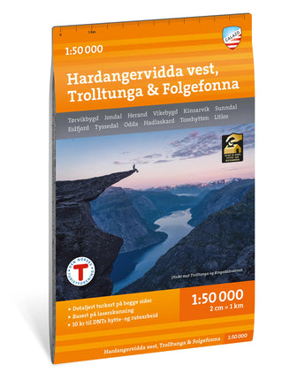


Turkart Hardangervidda vest, Trolltunga & Folgefonna 1:50 000
€22,90
/
Out of stock
Thank you! You will receive an email when Turkart Hardangervidda vest, Trolltunga & Folgefonna 1:50 000 is back in stock.
There was an error signing up for restock notifications. Please try again.
Temporarily out of stock.
Enter your email address below and you will receive an email when the book is back in stock.
With map coverage on both sides, this map covers the western parts of Hardangervidda, Sørfjorden and Folgefonna National Park, including popular destinations such as Trolltunga, Søtefossen and Hårteigen (1,690 m).
The map is part of Calazo's modern map series, featuring unique detail based on new data collected through airborne laser scanning. It covers the most popular mountain areas, marked hiking routes, DNT cabins and privately operated mountain lodges. The map is equally useful in winter with marked winter routes and groomed cross-country ski trails. Double-sided map: 70 × 100 cm.
The map is printed on Tyvek, a synthetic fibre material that makes it completely waterproof and highly tear-resistant.
The map is part of Calazo's modern map series, featuring unique detail based on new data collected through airborne laser scanning. It covers the most popular mountain areas, marked hiking routes, DNT cabins and privately operated mountain lodges. The map is equally useful in winter with marked winter routes and groomed cross-country ski trails. Double-sided map: 70 × 100 cm.
The map is printed on Tyvek, a synthetic fibre material that makes it completely waterproof and highly tear-resistant.
About: Turkart Hardangervidda vest, Trolltunga & Folgefonna 1:50 000
| Category | |
|---|---|
| Scale | |
| Last revised | |
| Map sheet size | |
| Material | |
| ISBN | |
| Locations |
About Tyvek
What is the material of the maps?
Calazo maps are printed on Tyvek, a lightweight, durable and water-resistant material that combines the feel of paper with superior durability. Tyvek can withstand repeated folding, rain and wear without fading colors or damaging the map, making it ideal for outdoor adventures in all weathers.
Shipping & Delivery
- Free shipping on purchases over 99 Euro
- Order before 12 noon on weekdays → shipped the same day
- Questions? info@calazo.se
Map scale
- 1:100,000 gives a better overview of larger areas.
- 1:50,000 is suitable for mountain hiking.
- 1:25,000 is used for detailed orientation, for example when following paths, mountain terrain or smaller trails.
Collaboration with DNT
For every map sold with the DNT logo, Calazo donates 10 kronor to DNT's cabin fund.
Others also bought
New

Stockholm Archipelago Trail
€19,90
/


Grövelsjön & Rogen 1:50 000
€19,90
/


