
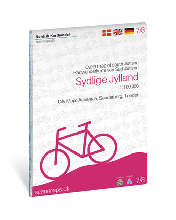


Cykelkort Sydlige Jylland 1:100 000
Discover Southern Jutland by bike with a detailed cycling map that helps you plan both shorter outings and longer cycling tours. The map shows an extensive network of European, national, regional and local cycle routes, as well as specially selected panoramic routes.
It gives you a good overview of cycle paths, sights and practical services along the way.
The map includes
- Cycle routes and cycle paths: EuroVelo routes 3, 10 and 12.
- National cycle routes 1, 3, 4, 6 and 8.
- A large network of regional and local cycle routes.
- Regional route 27, which follows the Tour de France route.
- Panoramic routes 401–407.
Towns and areas
- Town maps of Tønder, Aabenraa and western Sønderborg.
Services and sights
- Grocery stores and bike shops.
- Tourist offices and national attractions.
- Campsites and hostels.
- Tent sites and bathing beaches.
- Cyclist-friendly churches and other places to visit.
The map also contains practical information on topics such as accommodation and taking your bike on the train.
The map was originally published by Scanmaps and last updated in 2023. In autumn 2026, Calazo took over part of the Scanmaps map range. These maps differ in appearance and content from Calazo’s other maps and will gradually be replaced by new editions following Calazo’s map standard.
The map covers: Tønder, Aabenraa og Sønderborg vest
Fakta: Cykelkort Sydlige Jylland 1:100 000
| Kategori | |
|---|---|
| Skala | |
| Senast reviderad | |
| Material | |
| ISBN | |
| Ortsnamn |
Frakt & Leverans
- Fri frakt vid köp över 399:-
- Beställ före kl 12 på vardagar → skickas samma dag
- Frågor? info@calazo.se
Skala på kartan
- 1:100 000 ger bättre översikt över större områden.
- 1:50 000 passar fjällvandrig.
- 1:25 000 används vid detaljerad orientering, till exempel när du följer stigar, fjällterräng eller mindre leder.
Andra köpte även


