
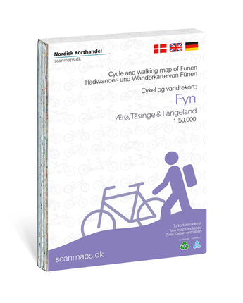


Cykel- og vandrekort Fyn, Ærø, Tåsinge og Langeland 1:50 000
Discover Funen and the South Funen Archipelago by bike or on foot with two detailed maps that inspire new outings and longer tours. The maps cover Funen and the islands of Ærø and Langeland, and show an extensive network of cycle routes and hiking trails.
They give you a good overview of routes, towns, sights and practical services along the way.
The cycling maps include
- European cycle route 10 (EuroVelo).
- National cycle routes 6 and 8.
- An extensive network of regional and local cycle routes.
- The new Manor House Route (Herregårdsruten), which circles Funen and continues to Ærø and Langeland. Along the way, the route passes several manor houses, estates and castles.
- 11 local cycle routes on Funen: L1 Ringe–Korinth, L2 Odense Å, L3 Langesøstien, L4 Tietgen, L5 Blangsted, L6 Hestehave, L7 Bellinge, L8 Søhus, L9 Stige, L10 Ryds Å and L11 Næsby.
Towns and areas
Four town maps are included: Odense, Svendborg, Middelfart and Nyborg.
Hiking trails
Map 1 – Funen
- Odense–Enebærodde–Dallund Slot.
- Den Nordfynske Kyststi.
- Langesø–Elmelundskoven.
- Øhavsstien.
- Lillebæltstien.
- Staurby Skov.
- Rød sti Middelfart.
- Rød Kløversti Middelfart.
- Blå Kløversti Middelfart.
Map 2 – Funen and the islands
- Øhavsstien.
- Klokkefrøstien.
- Kyststien på Ærø.
- Langeland Rundt.
- Langelands Stivenner (Hou).
- Langelands Stivenner (Snøde Udflytter).
- Lohalsruten.
Services and sights
- Grocery stores and bike shops.
- National attractions and tourist offices.
- Campsites, tent sites and hostels.
- Bathing beaches and cyclist-friendly churches.
- Specially marked rest areas for cyclists.
The maps also contain practical information on topics such as accommodation and taking your bike on the train. The marked cyclist rest areas are a feature unique to Funen and make it easy to plan breaks along your ride.
The maps are based on map data from the Danish Agency for Climate Data (Klimadatastyrelsen). They are printed on waterproof stone paper, a material that is easy to fold and unaffected by moisture and rain. The matte surface ensures good readability, and the material can be folded without the wear and tear of ordinary paper. Stone paper is made from limestone and requires neither water nor bleaching in the production process.
The maps’ table of contents is available in Danish, German and English.
The maps were originally published by Scanmaps and last updated in 2025. In autumn 2026, Calazo took over part of the Scanmaps map range. These maps differ in appearance and content from Calazo’s other maps and will gradually be replaced by new editions following Calazo’s map
The map covers: Odense, Svendborg, Middelfart og Nyborg
Fakta: Cykel- og vandrekort Fyn, Ærø, Tåsinge og Langeland 1:50 000
| Kategori | |
|---|---|
| Skala | |
| Senast reviderad | |
| Material | |
| ISBN | |
| Ortsnamn |
Frakt & Leverans
- Fri frakt vid köp över 399:-
- Beställ före kl 12 på vardagar → skickas samma dag
- Frågor? info@calazo.se
Skala på kartan
- 1:100 000 ger bättre översikt över större områden.
- 1:50 000 passar fjällvandrig.
- 1:25 000 används vid detaljerad orientering, till exempel när du följer stigar, fjällterräng eller mindre leder.
Andra köpte även


