
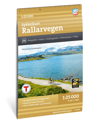


Sykkelkart Rallarvegen 1:25 000
€22,90
/
Nyhet
✓
Ship within 24h
Norway's most beautiful cycle route!
Rallarvägen is an 80-kilometer-long cycle route from mountain to fjord. The route takes you along the Bergensbanan and Flåmsbanan railways through a fantastic high mountain area up to an altitude of 1,340 meters and down to the sea in Flåm. Along the route there are several nice restaurants and places to stay overnight.
Bicycle rental is available via Haugastøl Turistsenter and Flåm Bike Rental. You can bring your own bicycle on the train and it is also possible for you to have your luggage transported between the train stations in Haugastøl, Finse, Myrdal and Flåm.
The entire route is usually passable in early July and the season lasts until the end of September, with marked winter trails and prepared ski tracks.
By purchasing this map, you help to secure the future of DNT's trails and overnight cabins. Calazo donates 10 SEK per map sold to DNT's work.
Locations: Haugastøl, Finse, Hallingskeid, Vatnahalsen, Flåm
About: Sykkelkart Rallarvegen 1:25 000
| Category | |
|---|---|
| Scale | |
| Last revised | |
| Map sheet size | N/A |
| Material | |
| ISBN | |
| Locations |
About Tyvek
What is the material of the maps?
Calazo maps are printed on Tyvek, a lightweight, durable and water-resistant material that combines the feel of paper with superior durability. Tyvek can withstand repeated folding, rain and wear without fading colors or damaging the map, making it ideal for outdoor adventures in all weathers.
Shipping & Delivery
- Free shipping on purchases over 99 Euro
- Order before 12 noon on weekdays → shipped the same day
- Questions? info@calazo.se
Map scale
- 1:100,000 gives a better overview of larger areas.
- 1:50,000 is suitable for mountain hiking.
- 1:25,000 is used for detailed orientation, for example when following paths, mountain terrain or smaller trails.
Collaboration with DNT
For every map sold with the DNT logo, Calazo donates 10 kronor to DNT's cabin fund.
Others also bought
New

Stockholm Archipelago Trail
€19,90
/


Grövelsjön & Rogen 1:50 000
€19,90
/


